
real-estate-drone-photography-revolution-and-trends
A buyer can tell a lot from a sharp interior set, yet still feel unsure about the one thing that matters most: how the home sits on the land and in the neighbourhood, making drone photography for real estate an invaluable tool for providing that overview. Drone photography answers that question in seconds. It gives scale, orientation, privacy, views, access and context, all in one coherent visual story.
Across Australia, aerial property media has moved from a novelty to a practical marketing standard. The best results are not about flying higher or faster. They come from planning, restraint, strong composition, careful flight time, and a clear respect for safety and privacy.
Ground-based photography is naturally selective. It frames what’s close, hides what’s awkward, and often compresses space. Aerial work does the opposite. It clarifies.
From above, buyers can read the property as a whole: the roofline and extensions, the true size of the yard, the slope of a block, where outdoor living actually sits, and how neighbouring buildings relate. That clarity tends to reduce uncertainty, which is often the silent barrier between an online click and a booked inspection.
Aerial media also helps different property types speak their own language. A coastal home can show proximity to the shoreline without overselling it. A rural holding can show paddock layout, access points, and tree cover. A townhouse development can show the street context and the reality of parking without guesswork.
One strong aerial still can do what ten ground shots cannot.
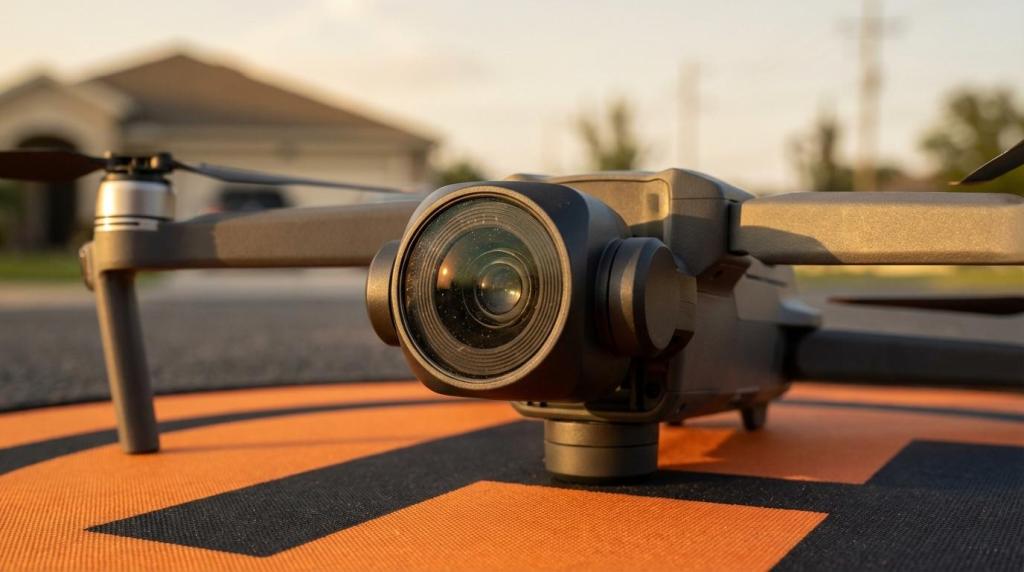
Modern real estate drone imaging work in Australia is typically captured with stabilised camera drones producing high-resolution stills and 4K video (and beyond, depending on the platform). Some projects call for more specialised sensors, especially in commercial property, development sites, and building assessment.
The useful shift is not only resolution. It’s control: better stabilisation, improved dynamic range, and smoother motion that feels cinematic without becoming distracting.
Here’s a practical way to think about the current toolkit.
[markdown] | Drone/capture type | Best suited to | What it communicates well | Watch-outs | | --- | --- | --- | --- | | Compact camera drone (sub-250 g or small prosumer) | Tight suburban blocks, quick exterior sets | Roof form, yard shape, street feel | Wind tolerance, limited sensor size | | Prosumer 4K–6K camera drone | Most residential and prestige listings | Hero angles, elevation reveals, smooth orbit video | Requires good light and careful flight planning | | Commercial platform with zoom options | Larger sites, multi-storey exteriors | Façade detail, balconies, building setbacks | More complex risk management | | FPV-style fly-through (where appropriate) | Hospitality, lifestyle, and certain architectural homes | Energy, movement, “being there” feel | Not always suited to conservative campaigns | | Thermal or inspection-focused payloads | Asset checks, energy and roof insights | Heat loss patterns, moisture indications, and roof anomalies | Not a marketing gimmick; context and permissions matter | | Mapping/modelling workflow (photogrammetry, LiDAR, where used) | Developments, land, commercial | Site shape, levels, planning context | Data processing time, specialised deliverables | [/markdown]Good drone media is chosen, not collected. The aircraft is just the platform; the imaging deliverable is the point.
Drone photography for real estate is often described as “a wow shot”, but its real value is practical. It gives buyers the missing reference points they use to judge suitability, lifestyle and long-term value.
That shows up in the kinds of questions aerial imagery answers without a phone call: how private is the yard, where does the sun fall, how close are neighbours, what’s behind the tree line, what’s the driveway access, and what does the street really look like?
After a strong ground-photo set, aerials tend to lift the listing in three simple ways:
Effective drone work begins before take-off. The goal is to tell the truth beautifully, with a shot plan that supports the listing narrative and the buyer’s decision-making process.
A typical residential aerial plan might include a clean establishing frame, one or two “feature and context” angles, and a short sequence of video clips that can be edited into a tight walkthrough opener for online listings and social placements. The most common mistake is overshooting: too many similar orbits, too much height, and not enough intention.
A practical workflow often looks like this:
Planning also includes how the aerials will be used. A single hero still for the listing thumbnail needs different thinking from a 20-second video opener, and both differ again from a developer’s progress update.
In Australia, drone operations fall under CASA rules, and commercial work typically requires appropriate licensing, registrations, and procedures. The basics that buyers and sellers notice are simple: the flight time is calm, controlled, and respectful.
The basics of CASA expectations that many operators work within include keeping the drone within visual line of sight, staying below 120 m above ground level, and keeping clear of people not involved in the activity. There are also strong constraints around flying near airports, emergency operations, and over populous areas or gatherings.
Then there’s the local layer. State parks, council-managed land, and major-event zones can carry extra restrictions about where you can take off, land, or operate at all. This matters in the real world because many good vantage points are in public reserves, foreshore areas, or park edges.
Privacy is the other pillar. Even when an operation is lawful, people can still feel uneasy when they see a drone nearby. Good practice is straightforward: communicate, keep flights short, avoid pointing into neighbouring yards or windows, and focus framing on the property being marketed. Where organisational privacy obligations apply, it’s wise to treat notice and data handling as part of the job, not an afterthought.
A well-run shoot looks professional because it is professional.
Drone imaging files often arrive crisp and contrasty, which tempts heavy-handed grading. Real estate campaigns benefit from discipline: natural colour, straight horizons, and sharpness that reads as high quality without feeling artificial.
Editing also affects trust. Buyers know when an image is trying too hard.
A good aerial edit tends to prioritise:
Video pacing matters too. Short, purposeful clips with optimised flight time tend to perform better than long, looping flights. Many campaigns benefit from 15 to 45 seconds of aerial video that sets the scene, then hands off to interior footage and floor-plan context.
Drone content shines when it is part of a complete visual package. Aerials answer “where is it and what surrounds it?”, while ground photography answers “how does it feel inside and at eye level?”. Floor plans answer “how does it flow?”
When these pieces are planned together, the listing becomes easier to read. That can mean fewer mismatched expectations at open homes and better quality enquiries.
A simple structure that works well for many campaigns is:
The next wave is less about higher resolution and more about new ways of telling the story.
FPV sequences are gaining attention for hospitality and lifestyle properties, where energy and movement can suit the brand. In the right setting, they can create a “walk and fly” feeling that standard gimbal footage cannot match. They are not a fit for every campaign, and many residential listings still benefit most from classic, stable motion.
3D modelling and mapping outputs are also becoming more common around development sites and large acreage properties. Buyers, planners, and investors often want more than a pretty angle. They want measurable context.
At the same time, expectations are rising. Once buyers get used to aerial context, they start to look for it. This pushes the industry toward better planning, better pilots, and stronger creative direction.
AND Photography offers professional photography and videography services tailored to real estate, commercial, and hospitality properties, with drone footage and floor plans available as part of the service mix. With 11 years of experience, the company has supported over 9,700 satisfied clients and captured more than 8,300 properties across these sectors.
That kind of volume matters because aerial work is rarely “one size fits all”. A compact inner-city block, a new build on a tight-access street, a resort with landscaped grounds, and a commercial site with multiple entries all call for different angles, heights, and a different sense of pace.
The most inspiring drone photography for real estate is not about showing off the drone. It’s about giving buyers a clear, confident view of what they’re actually considering, from the ground up and from above.